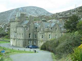
Tuesday 14 May – Barra/Vatersay
A wild night, the van being blown about even though we were
parked “into the wind” but by morning it had blown itself out and although the
sea was still rough with big swells, it was actually quite pleasant.
 |
| Kisimul Castle, for which Castlebay is named |
Our first call was to the Tourist Information office in
Castlebay, the main (only) town for a decent map of the islands and information
about LPG availability before setting off to explore. Barra is quite a small
island and is connected by a causeway to Vatersay, an even smaller island to
the south. There are more islands even further south but not accessible to
motor vehicles – or even pedestrians!
We had noted that there were supposed to be some fine
beaches on Vatersay with possibility of wild camping, however it did not appear
to be very tourist friendly, well not with a motorhome anyway, and we only
found one place we could actually park – it then started to rain so we gave it
up after a short stay and returned to Barra.
 |
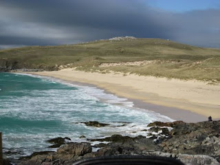
| The beach just north of Gorve |
A road runs all the way around Barra so we turned up the
west coast and made our way north. With the weather starting to improve so did
the scenery, although despite what the guidebooks would have you believe, apart
from the occasional seascape, we didn't find Barra all that attractive. A road
branches off this “ring road” to the Eriskay ferry and the airport – yes this
tiny island has a unique airport with scheduled flights to the mainland, the
runway being the beach at low water. We saw one scheduled flight and several
private light aircraft using the airstrip.
 |
| Fuday, uninhabited island between Barra and Eriskay |
The road continues further on, right up to the northernmost
point (that bus driver lady must have got fed up with us, we got in her way
everywhere!). We stopped off at Eoligarry where there was an approved wild-camping spot with basic facilities for maybe 4 vans, for lunch but decided
that despite the views to the other islands (and Skye in the far distance) it wasn't particularly attractive. There were also 2 “campsites” right at the
north end but one was CCC members only and the other was nothing more than a
rough hillside with a tap – okay for some we suppose but not us.
We returned south along the east coast, past two more
proper, i.e. commercial, campsites with a short wrong turn that nearly saw us
on the Eriskay ferry. In retrospect this seemed a nicer part of the island,
although the blue sky and sunshine probably helped. Just before Castlebay we
stumbled on a parking area with a superb view over Castlebay and the distant
islands. We could have probably overnighted there, the adjacent house not being
occupied, but decided to return to Gorve with all its facilities.
 |
| View over Castlebay |
To be fair to Barra, it is still very early in the season
and the flora for which the islands are noted is not yet established. However
it does have some attractive scenery which is best viewed in good weather
conditions – which we have been promised for later in the week!
Wednesday 15 May
Barra is one of the smaller inhabited islands of the Outer Hebrides and we’ve probably seen all of it so today we’re going to island-hop across to Eriskay. Several daily sailings so no rush and although we had been warned that some CalMac ferries had been cancelled due to weather, the Eriskay service was running normally. Not having booked we were a little uncertain but it was no problem although the man said it would be better to book to ensure we got a place if it was busy.
 |
Otter sculpture at the ferry port
|
Crossing was a bit wobbly but no problems and it was only 40mins later we landed on another tiny island with, apart from the main road through, only there-and-back roads which of course were investigated. However again there was nothing of interest, not even any notable scenery so onward to South Uist, this time across a causeway.
South Uist is much larger and consists of a low western strip of white sandy beach backed by “machair”, the rough grass on sand which contains a large variety of wild flowers, unfortunately not yet out, and a hilly (mountainous?) spine lowering to a rocky east coast. With the weather slowly improving we started to see some of the views for which these islands are renowned.
A visit to the T.I. office in Lochboisedale, the main town, lunch in their car park (where we also got a good BTFon signal) then off to explore. Basically we investigated all the wild camping spots, working our way up the island. With the weather still windy and showery we decided being on the west coast was not the best idea so chose to stay at a spot at Loch Sgioport, just a layby really, but totally isolated and protected by the hills.
 |
Our pitch for the night
|
A short walk down to an abandoned fishing quay (see photo below) then return to Bertie for a quiet evening as the wind dropped and the rain dried up.


